
This article describes the visualization of the changing history of Bözen and its historical buildings. We are using a novel combination of archival data, old maps and geographic information systems to provide extensive documentation of notable houses.
Bözen, a small rural village
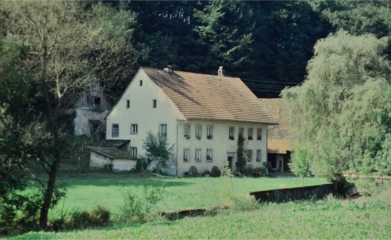
Until well into the 20th century, the community of Bözen in the upper Fricktal was a typical street village. The houses stood along the main traffic routes. More than half of the inhabitants were farmers. It was not until the post-war period that agriculture changed fundamentally, and many small and medium sized farms disappeared. With the onset of industrialization and the arrival of the chemical industry in the Fricktal, new jobs were created. Thanks to the increasing prosperity, existing residential property could be modernized, and new houses were built. Affordable building land and better transport connections caused a further expansion of the settlement area.
To cope with the increased traffic, the main road was widened around 1980 and some of the older buildings close to the street had to make way for the road construction. After the opening of the last section of the A3 motorway the village was relieved from the heavy traffic. The A3 connected the Fricktal with the A1 motorway in Birrfeld that led to Zurich and Bern.

In this aerial photograph taken about 70 years ago, the original character of the village is still clearly visible. Although a considerable number of the houses were less than a hundred years old, the great post-war boom had not yet set in. Most of the buildings however were older, some dating back to the 16th century.
Tracing the history of these buildings is not easy as the sources are scanty. However, this changed with the introduction of fire insurance for buildings.
The introduction of Fire Insurance
The history of building insurance in Switzerland began in the year 1805 in the canton of Aargau. In the Fricktal, which originally belonged to the Austrian Breisgau, there was already compulsory fire insurance. This went back to a decision by Empress Maria Theresia (1717-1780). The example of the canton of Aargau was followed by the cantons of Zurich, Solothurn and Schaffhausen and the other cantons. This historic decision was a sign of great foresight and from then on spared the victims a great deal of hardship and misery. Before 1805, anyone who lost their possessions in a fire was not entitled to any financial or material aid. The injured parties were responsible for repairing the damage themselves. Since hardly anyone had enough funds or resources to cope with the damage, entire families were plunged into hardship and misery. With the establishment of the building insurance, this unsatisfactory situation came to a good end.
For this purpose, a directory of houses was created for each village in Aargau with a brief description of the condition of the buildings and the insurance value, the Fire Insurance Registers. These have been largely preserved and are available in the Aarau State Archives. Thanks to these sources, histories of houses can be compiled.
After two to three decades, a new register was created (1809, 1829, 1850, 1876, 1899). The numbering of the houses was arbitrary and changed with each new edition. This makes it difficult to track the history of a given house. It was not until 1899 that the conclusion was reached that the Insurance Number of a property should remain unchanged. The register not only contains information on changes in value, such as alterations and renovations, but also changes of ownership.
Unfortunately, the 1850 edition of the register is missing for Bözen. Changes of ownership for the period from 1850 to 1876 must therefore be traced using other sources, such as the sales transaction records available in the Bözen municipal archives. In these, purchase contracts of all kinds were recorded.
Together with other people interested in local history, the histories of these houses are now gradually being worked out. This is not always easy since historical map material at this level is lacking. As a supporting aid we use the cadastral map of 1947 as well as a local map, which was created for the purpose of the property regulation of 1935. The latter contains the insurance numbers of the houses.

At the top right of the image is the church building with numbers 41A and 41B, a staircase leads up to the churchyard. Objects marked in color (green in above image) and without hatching have already been documented. The level of detail of this map is illustrated in the lower right half of the image. Every single fruit tree is listed and marked with a capital letter (Z=plum, A=apple, B=pear, N=nut, Q=quince, K=cherry).
This shows how important the orchards were in the valuation of the farmland that was exchanged to consolidate land ownership.
Online Visualization
In cooperation with Peter Berger, expert for geographic information systems, a modern and interactive map series with the title “Bözen in the change of time” was created.
This platform is based on open source mapping software (GIS), QGIS. The webserver system consists of Apache2, PHP, QGIS Server etc. and Lizmap. This requires an operating system, in this case Linux OS Ubuntu 22.04 LTS is used. All this runs on a virtual cloud server.
This series of maps combines publicly available data and privately digitized maps from the municipal archives of Bözen with compiled house histories. For easy visualization, the municipality map of Bözen from 1947 was used. Buildings are identified by address and building insurance number. The user interface is intuitive, comparable to the geoportal of the canton of Aargau (AGIS – Aargauisches Geografisches Informationssystem).
On the menu bar on the left side, additional layers of geographic and historical interest can be selected. For example, the Siegfried map from 1926, which shows the enormous extent of the vineyards at that time. Further layers with historic and current maps or satellite views from Google are also available.
The layers are arranged hierarchically. The active layer on top overwrites or completes the layers below. With a mouse click on a color-coded building or object, a link to the detailed information as a PDF file appears in a popup window. Other functions such as “Print” and “Measure” are also available.
- green: buildings with detailed Information
- red/green: Demolished buildings with detailed Information
- red/salmon: demolished and disappeared buildings
Boundary Stones (Folder Grenzsteine_nach_Urs_Frei)
Urs Frei has documented the ancient boundary stones for Bözen, marked in blue. These date from the days before the canton Aargau was founded. At that time, the lower Fricktal belonged to Habsburg empire and only the upper part of Fricktal was Swiss territory. By clicking on the blue boundary stones a popup menu box appears. There you can find links to more detailed information about the specific boundary stone. Above the information provided by the canton of Aargau, below the detailed documentation by Urs Frei.
- blue/red dots: boundary stones of Bernese Aargau, not under monument protection
- blue dots: object subject to cultural monument protection of canton Aargau
Disappeared Objects (Folder Verschwundene_Objekte)
Some buildings, the water channels for the grist mill and the mill pond have disappeared. Based on the municipality map of 1947, additional sources in the municipality and state archive as well as terrain data (Digital Elevation Model), an attempt is made to project their location on today’s maps.
Protected Monuments (Folder Schutzobjekte)
- blue dots: cultural monument protected by Canton Aargau
- red/white dots: classified community cultural objects
- red dots: important objects in community inventory
Example of a building documentation – Hauptstrasse 39 “Ursis”
Hans Wassmer, the author of the Bözen village history, describes this house located on the main street as follows:
“This beautiful building constructed in the middle of the 19th century has interesting features. It differs from the other classicist houses in two ways:
The central part of the front slightly protrudes from the facade. This emphasized part is completed by a wide-angled pediment. It is in accordance with the classicist practice, which recalled ancient origins in the construction method. Many buildings from the classicism period are characterized by this gable shape. Initially, house No. 79 served for a long time as an inn with a shop. Later, the owner is said to have been suggested to give up the restaurant business due to the decreasing number of inhabitants. As a substitute he was offered to run the post office.”

In the property register of 1872 the building is listed for the first time. The building number was 99 which implies that it had been added to the fire insurance registry later after its initial compilation. The house was constructed in 1863 as can be seen in the engraving above the entrance.
According to sales transaction records, the builder was Jakob Heuberger (1799-1881), known as “alt Krämerheiris”, who then passed it on to his son Hans Jakob (born 13.5.1839) two years later. His sister Maria was married to Wilhelm Weber of Menziken and received the lifelong right of residence in the apartment in the building next door which he also owned. At that time, the Weber-Heuberger couple owned the stately home opposite Restaurant Post, which was demolished when the main street was widened around 1974.
In the fire registry of 1876, the owner was Jakob Heuberger, the son of the builder. The value of the house was 12,600 francs, one of the most valuable houses in the village at that time.
In the fire insurance register of 1899, the ownership of the house remained unchanged, Jakob Heuberger ran a tavern there at that time. From 1909 it belonged to his son, Arnold Heuberger, the postmaster.
In 1924 the house was purchased by Hans Pfister-Brändli, a local farmer nicknamed “Ursi Hans”. He was a descendant of the large Pfister family, known as “Becklihansen”.
Ownership history
1863: Construction by Jakob Heuberger (1799–1881)
1865: Handover to son Jakob Heuberger (1839–1907), he operated a tavern
1909: Arnold Heuberger (1867–1923) Post Office
1924: Hans Pfister-Brändli (1888–1974)


